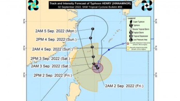
Typhoon Henry (Hinnamnor) continues to pummel Batanes and Babuyan Islands with heavy rains and gusty winds as it continues to slow down over the Philippine Sea Friday, the weather bureau said.
In its 5 a.m. bulletin, the Philippine Atmospheric, Geophysical and Astronomical Services Administration (PAGASA) said “Henry” would enhance the southwest monsoon which may bring rains over the western section of Luzon beginning Saturday.
“Henry” packs maximum sustained winds of 175 kilometers per hour near the center and gustiness of up to 215 kph.
It was last tracked 395 km. east northeast of Basco, Batanes, and is almost stationary.
Moderate to heavy rains are likely over Batanes, Babuyan Islands, Ilocos Norte, and Abra.
Light to moderate with at times heavy rains are also possible over Cagayan and the rest of Ilocos Region and Cordillera Administrative Region.
Isolated to scattered flooding and rain-induced landslides are possible, especially in areas highly susceptible to these hazards.
Tropical cyclone wind signal no. 1 has been hoisted over Batanes, Babuyan Islands, and the northeastern portion of mainland Cagayan (Santa Ana).
Strong breeze to near gale strength winds will be experienced in these areas.
Strong to gale force winds and rough to very rough seas will continue to prevail over the northern and eastern seaboards of Northern Luzon (Batanes, Cagayan Including Babuyan Islands, Isabela, and the northern coast of Ilocos Norte).
Moderate to strong winds and moderate to rough seas are also forecast over Central Luzon.
Fishing boats and other small sea vessels are advised not to venture out into the sea, while large sea vessels are alerted against big waves.
Meanwhile, the rest of the country will experience isolated rain showers caused by localized thunderstorms.
Light to moderate winds and slight to moderate seas will prevail over the rest of the archipelago, PAGASA said. (PNA)


