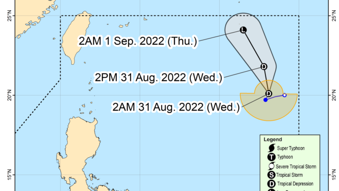
The low pressure area (LPA) east of extreme Northern Luzon developed into Tropical Depression Gardo on Monday afternoon, the Philippine Atmospheric, Geophysical and Astronomical Services Administration (PAGASA) said.
Its trough will cause scattered rains and thunderstorms over the region Calabarzon and the provinces of Aurora and Camarines Norte.
Flash floods and landslides are possible due to light to moderate, to at times heavy rains.
In a bulletin sent at 5:24 p.m., PAGASA said “Gardo” was last tracked 1,185 km. east of extreme Northern Luzon, moving west southwestward at 15 kph.
It packs maximum sustained winds of 55 kph near the center and gustiness of up to 70 kph.
PAGASA said “Gardo” is unlikely to have a direct effect on the country’s weather condition. Further, it is unlikely to directly affect the sea conditions of the country’s coastal waters.
“Gardo” may intensify into a tropical storm in the next 24 hours.
PAGASA forecast “Gardo” to degenerate into a remnant low by Thursday afternoon. (PNA)


